Lemosho Route
per person
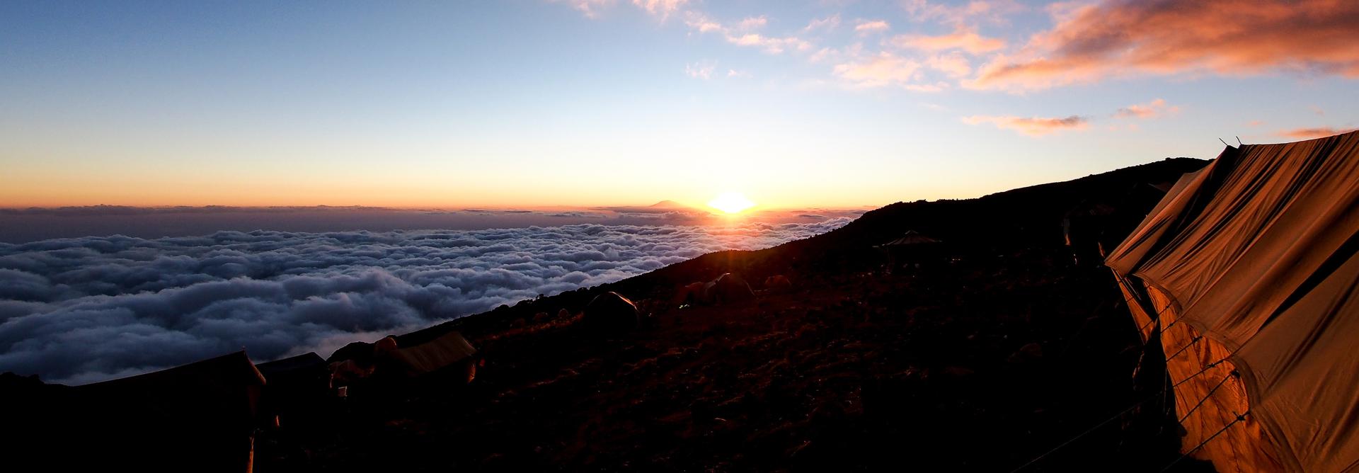
The Lemosho route is unspoiled Offering captivating stunning panoramas, pristine wildlife, outstanding acclimatization opportunities and the lowest traffic of other hikers. The route is one of the few where groups may be accompanied on the first day by an armed ranger, as the forests around the Lemosho Glades are inhabited by buffalo, elephant and other wildlife. This rote can be completed in 6days. However we recommend hiking the route in 7 days, because the extra 7th day will give you more time to acclimatize and reducing the effects of altitude sickness and give you more time to rest before attempting to reach UHURU PEAK (5,895 M)
0
Reviews
-
Departure/Return Location
Arusha City
Tour Plan
1
Londorossi Gate to Mti Mkubwa
Hiking approximately time: 3 ½ hours
distance: approximately 5.4 km
habitat: montane forest
Your day starts early with a briefing, followed by breakfast and a 3-4hours drive from Arusha/ Moshi to the Londorossi Park Gate (2100m). after registration formality, we continue by vehicle, a further 12km on a forest track that leads to the Lemosho starting point (2244m). The group continues upwards towards their drop off point by off-road vehicles (reaching 3,500 meters). Here you can see a spectacular view of the Shira Plateau for the first time.
The route from your drop off point to your first high-altitude camp Shira 2 features a moderate gain in altitude and is not too physically challenging. Due to this, you will be able to properly begin the process of acclimatization. By the time you reach at the camp, you will find our crew already set your tent .the crew will prepare everything necessary, dinner and overnight .
2
Mti Mkubwa to Shira Camp 1
Hiking approximately time: 8 hours
approximately distance: 15.6 km
Habitat: Moorland
Wake up early morning for breakfast start walking through the forest which may take an hour to the end of the forest and then the trail gradually steepens and enters the giant heather moorland zone. Several streams are crossed. After 8.1 km we reach Shira 1 camp (3504m) located on the Western edge of the Shira Plateau where we stop for lunch.
After lunch we hike across the Shira plateau for another 7.5km to the Shira 2 Camp, situated on the moorland meadows (3875m).
From this point, you will be able to view the Western Breach with its stunning glaciers. The crew will provide you washing water, before the chef serves dinner. The night at this exposed camp will even be colder than the previous night, with temperatures dropping to well below freezing
3
Shira Camp 1 to Shira Camp 2
- Distance: 6km
- Hiking Time: 2 hours
- Habitat: Moorland
4
Shira Camp 2 to Barranco Camp
- Distance: 7km
- Hiking Time: 6-8 hours
- Habitat: Semi Desert
5
Barranco Camp to Karanga Camp
- Distance: 5km
- Hiking Time: 4-5 hours
- Habitat: Alpine Desert
6
Karanga Camp to Barafu Camp
- Distance: 4km
- Hiking Time: 4-5 hours
- Habitat: Alpine Desert
7
Barafu Camp to Summit to Mweka Hut
- Distance: 5 km ascent / 12 km descent
- Hiking Time: 7-8 hours ascent / 4-6 hours descent
- Habitat: Arctic
8
Mweka Camp to Moshi
- Distance: 10 km
- Hiking Time: 3-4 hours
- Habitat: Rain Forest